
How to Organize Motorcycle Trips in Rural Areas & Cellular Dead Zones
A practical guide to leading group motorcycle rides where network connectivity fails: route caching, fuel logistics, and emergency offline protocols.
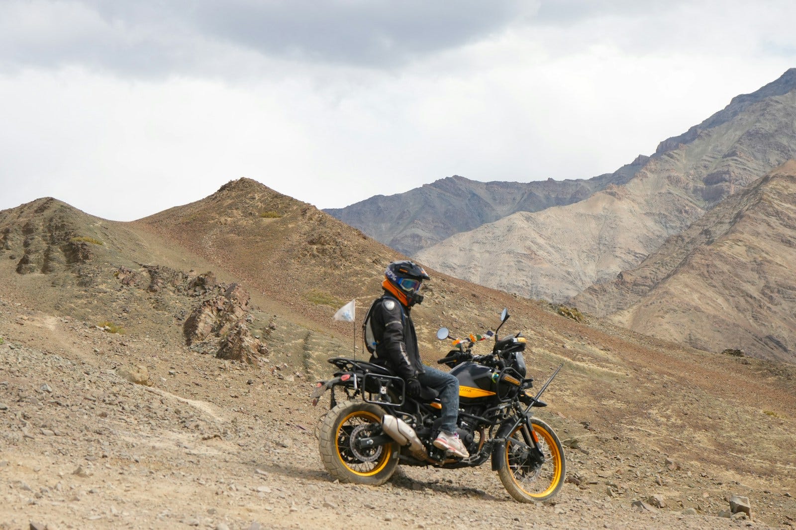
Quick answer: How do you organize a group motorcycle ride in remote rural areas? Leading rides through remote terrain or mountain dead zones requires four fail-safe protocols: (1) Pre-cache all route vectors and offline maps on every device before departure; (2) Adopt the "Corner Drop" (Drop-off) marking system at every rural fork so no rider makes an unescorted turn; (3) Refuel whenever the shortest-range bike hits half-tank, as rural petrol pumps frequently run dry or suffer power cuts; and (4) Use a dedicated group ride tracker like Wandr that stores waypoints locally and flags last-known coordinates when signal drops.
The moment your riding group leaves national expressways and turns onto rural backroads, the entire coordination dynamic changes.
Smooth asphalt narrows into gravel-strewn single-lane tarmac. Concrete highway dividers vanish, replaced by blind corners obscured by sugarcane fields, stray livestock, and sudden unmarked irrigation dips.
Most critically, the 4G and 5G signals on your handlebars quietly drop to zero.
In urban areas, disorganized groups survive on quick phone calls, WhatsApp messages, or shared live locations. But in deep rural corridors—whether cruising the remote ghat roads of the Western Ghats, winding through rural Madhya Pradesh, or climbing into Himalayan passes—you cannot dial a lost rider.
When a rider misses an unmarked rural turnoff in a dead zone, finding them can cost hours of back-tracking, wasted fuel, and dangerous roadside exposure.
Leading a group through rural territory requires deliberate preparation. Here is how experienced tour leaders organize and execute remote rides safely.
1. The Offline Routing Setup: Never Trust Live Cellular Data
Smartphones are remarkable navigation computers, but they are designed under the assumption of continuous cloud connectivity. When cell towers disappear:
- Cloud-dependent apps fail to load new map tiles.
- Search queries for nearby fuel stations or emergency mechanics return timeout errors.
- Messaging apps continuously poll cellular radios at full transmitter power, drastically heating up devices and draining batteries.
Pre-Ride Caching Protocol:
- Cache Offline Map Regions: In Google Maps, have every rider download offline maps covering the entire geographic radius of your rural tour before leaving home Wi-Fi.
- Pre-Save All Route Waypoints in Wandr: In Wandr, route plans are cached directly on device storage. Turn-by-turn guidance, waypoint sequences, and mileage counters continue to function flawlessly through zero-connectivity valleys.
- Carry Physical Route Cue Sheets: For multi-day expeditions in extreme wilderness (like Spiti Valley or Changthang), print compact, laminated cue cards listing rural village names, landmark forks, and local emergency phone numbers.
2. Master the "Corner Drop" System at Rural Junctions
In cities, riding in a tight staggered formation is easy. On winding rural roads with tractors, bullock carts, and stray cattle, keeping twenty bikes tightly clustered is both impossible and unsafe. Packs naturally string out over 2 to 3 kilometers.
To prevent trailing riders from taking the wrong fork when cell phones don't work, adopt the Corner Drop (or Drop-Off) System:
                  [Rural Fork Left] ──> LEAVE MARKER RIDER HERE
                         /
[Lead Rider] ───────────/
                        \
                  [Dead-End Right]
How the Corner Drop Works:
- The Lead Rider arrives at an unmarked rural junction or fork.
- The rider immediately behind the lead (Rider 2) pulls over safely at the corner, turns their bike toward the correct turn direction, and waits.
- The rest of the pack sees Rider 2 marking the turn, follows the indicated path, and continues riding.
- Rider 2 stays put until the designated Sweep Rider (identifiable by a high-visibility vest) arrives at the junction.
- Rider 2 gives the thumbs-up and slots in directly ahead of the Sweep.
Why this is foolproof: The pack never gets lost at an unmarked intersection, regardless of how far apart riders are spread, and nobody needs a phone signal to navigate.
3. Fuel Logistics in Remote Regions
Running out of fuel on a national highway is an inconvenience; running out of fuel on a remote state backroad with no mobile signal is a dangerous predicament.
RURAL FUEL REALITY:
[Highway Pump]  ──> 120 km ──> [Rural Local Pump] (Power Outage / Dry) ──> 90 km ──> [Town Pump]
(Always Fill)                    (Never Rely On It)                              (Empty Tank Risk)
3 Golden Rules of Rural Fuel Management:
- The Half-Tank Rule: When riding through rural corridors, never wait for your fuel light to blink. When the motorcycle with the smallest tank drops to 50% capacity, stop at the next available branded pump.
- Account for Power Cuts: Rural fuel stations frequently experience unscheduled electrical grid cuts and may lack functioning backup generators. If a pump cannot operate its electric meters, you cannot get fuel.
- Beware of Adulterated Fuel: In remote agricultural regions, local fuel stations often sell fuel mixed with kerosene or stored in rusted subterranean tanks. Stick to company-owned, company-operated (COCO) retail outlets whenever possible.
4. How Wandr Solves the Rural Dead Zone Problem
Most modern navigation and ride tracking apps are useless without continuous 5G data. Wandr was developed specifically around real-world touring realities:
- Offline Route Geometry: Your group's route itinerary—including primary destination and all intermediate waypoints—is stored locally on device memory. You never lose your navigation line when passing through dense forests or mountain shadows.
- Last Known Position (LKP) Radar: When a rider enters a dead zone, their avatar does not vanish. Wandr preserves their last verified coordinates and displays a subtle timestamp indicator ("Last seen 6 mins ago"), allowing lead riders to determine exactly where a separated rider entered the signal shadow.
- Intelligent Power Management: In rural riding, bikes frequently stop for rail crossings, herd crossings, or scenic viewpoints. Wandr detects zero velocity and dials down GPS polling to conserve battery life under intense heat.
- Passenger Mode for Support Vehicles: If your rural trip includes a support car or chase vehicle, the driver or passenger can view the entire convoy spread in Passenger Mode with minimal data and battery consumption.
5. Mandatory Rural Emergency Protocols
Before embarking into areas without hospital proximity or cellular coverage, verify these critical medical and mechanical safeguards:
Medical Readiness:
- Triage First Aid Kit: Pack pressure bandages, burn dressing, antiseptic iodine, sterile saline, splints, and rehydration salts.
- Blood Group & Emergency Info: Ensure each rider’s Wandr profile lists their emergency contact numbers and blood group, accessible instantly from the device without unlocking passwords.
Mechanical Preparedness:
- Tire Repair: 12V portable tire inflator and heavy-duty tubeless puncture repair kit. Rural roads are littered with agricultural nails and sharp gravel chips.
- Tow Strap: Carry a 4-meter motorcycle recovery tow strap. If a bike suffers a catastrophic electrical failure or broken chain in a dead zone, towing it to the nearest rural junction is your only option.
Frequently Asked Questions
How do you find a lost rider without phone signal?
Establish a strict "Stop and Wait" protocol during your morning briefing: If a rider realizes they have missed a turn and haven't seen another pack member for 5 minutes, they must pull over in a safe, visible spot and stop moving. The Sweep rider or a scout retraces the planned route backwards to locate them.
What is the Corner Drop system in group riding?
The Corner Drop (or drop-off) system is a convoy management method where the rider behind the lead stops at each turn to point the rest of the pack in the right direction, rejoining the pack only when the sweep rider arrives.
Do GPS apps work without cellular data on motorcycles?
Yes. Dedicated GPS receivers in modern smartphones connect directly to satellite constellations (GPS, GLONASS, Galileo) without needing cell service. Your own position keeps updating without signal, but live group positions and fresh routing need data. Download offline Google Maps areas, keep the planned route cached (as Wandr does), and agree regroup points before the dead zone.
The most rewarding rides lie far beyond the highway toll plazas. With disciplined corner marking, calculated fuel stops, and reliable offline tracking, rural riding is pure adventure.
About WANDR: WANDR is an Android app for motorcycle group rides. It combines riding groups, saved route plans with waypoints, turn-by-turn navigation, a live map of every rider and trip chat in one app, and shows when each rider reaches a stop. It's built for riding clubs, ride organizers and friends riding together. Get WANDR on Google Play.
Related Guides from the Wandr Journal
Your next ride starts with WANDR.
Download free for Android. Keep your crew, your route, and your journey connected on every mile.